Cloud types / Altocumulus
Altocumulus · Ac
| Cloud level | Mid |
| Altitude | Base roughly 2-7 km |
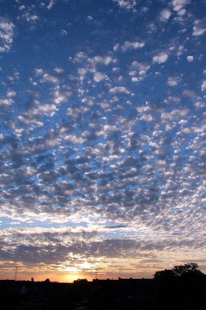
Altocumulus is a mid-level cloud layer appearing as white or gray patches, sheets, or rolls of flattened globular masses. Often arranged in parallel bands or orderly waves, individual elements typically exhibit dark shading underneath. As one of the most varied and common cloud genera, altocumulus reflects instability and moisture in the middle troposphere. Observing changes in its structure helps meteorologists track wave disturbances, shallow convection, and impending atmospheric changes.
How it forms
Altocumulus forms primarily through shallow convection, wave motion, or lifting within a moist mid-tropospheric layer. Droplets and ice crystals aggregate into organized rolls or cellular groups as air rises and cools at the wave crests while sinking and evaporating in the intervening troughs.
Identification keys
- White or gray patches, sheets, or rolls with shading
- Elements usually measure between one and three fingers wide at arm's length
- Arranged in waves, parallel bands, or cellular mosaics
- Composed mainly of supercooled water droplets, sometimes mixed with ice
- Occasionally exhibits corona or irisation along illuminated edges
Typical weather
Altocumulus normally yields no precipitation reaching the ground, though virga trails often dangle beneath elements. However, turreted forms like castellanus indicate mid-level instability and frequently foreshadow afternoon showers or thunderstorms later in the day.
Often confused with
Photography tip
Frame rows of altocumulus in late afternoon side-lighting to accentuate the textures, rolls, and dimensional shadows across the cloud deck.
Questions about this cloud
Can altocumulus produce rain?
Precipitation normally evaporates as virga before reaching the surface, though the cloud can indicate approaching storminess.
What do turret-shaped altocumulus clouds mean?
Altocumulus castellanus signals strong instability in the middle atmosphere, often warning of convective thunderstorm development within hours.
Got a photo like this? Run it through the identifier: